Since my planned birding day near Plymouth didn’t work out, I took Darren’s advice and checked out the Slimbridge Wetland Centre (also referred to as “Wildfowl & Wetlands Trust”) in Gloucestershire [map]. There’s a lot going at this remarkable place, but for birders (particularly out-of-country ones!) it was a bit confusing. The first part, near the visitor center, is a series of exhibits showcasing birds from around the world, including local birds! And although these birds are ostensibly “clipped” to keep them from flying free, I observed on a few occasions these birds making short flights that could carry them out of their “enclosure” habitats. I’ll post my eBird link after the photos (presented without commentary beyond captions), but take some of the duck and geese species with a grain of salt. I tried to weed out the “captive” species, but there may be a few of the ambiguous sightings that got left in.
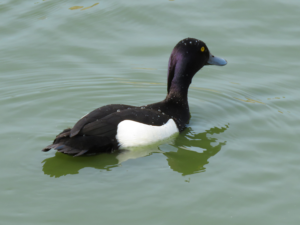
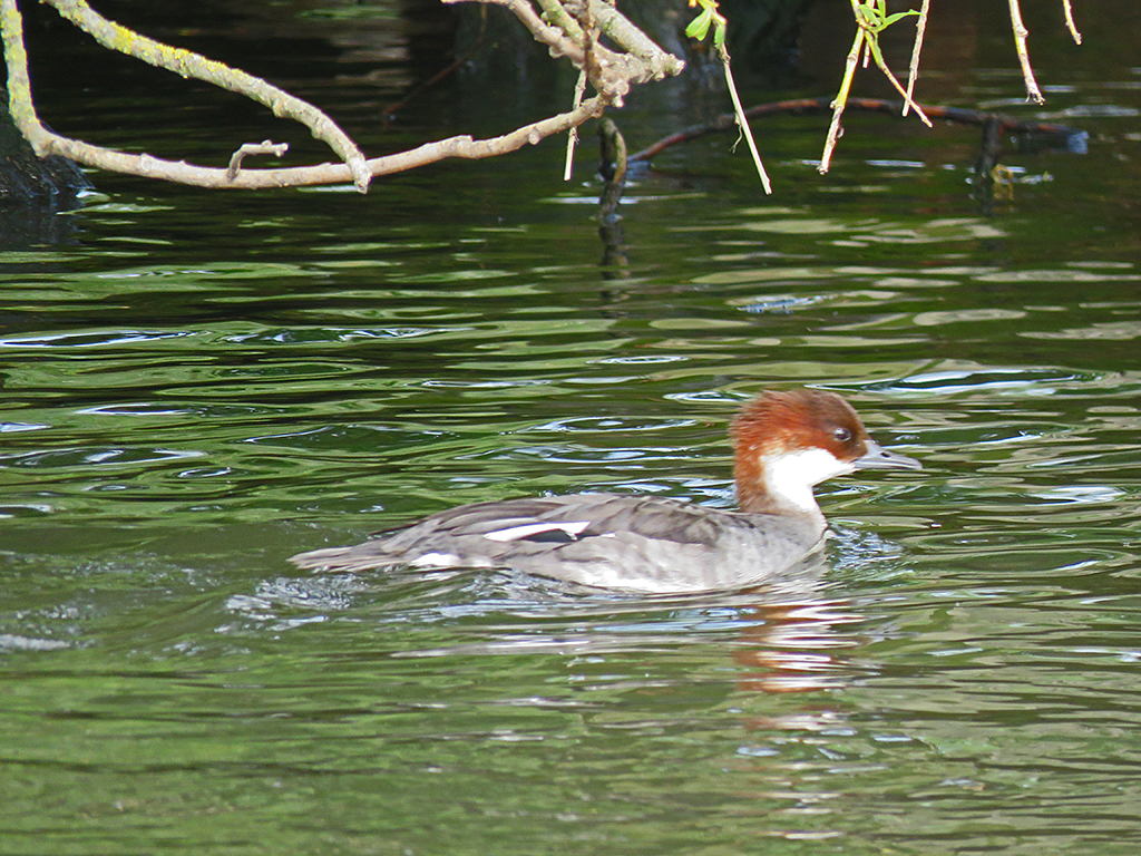
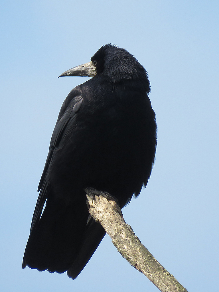
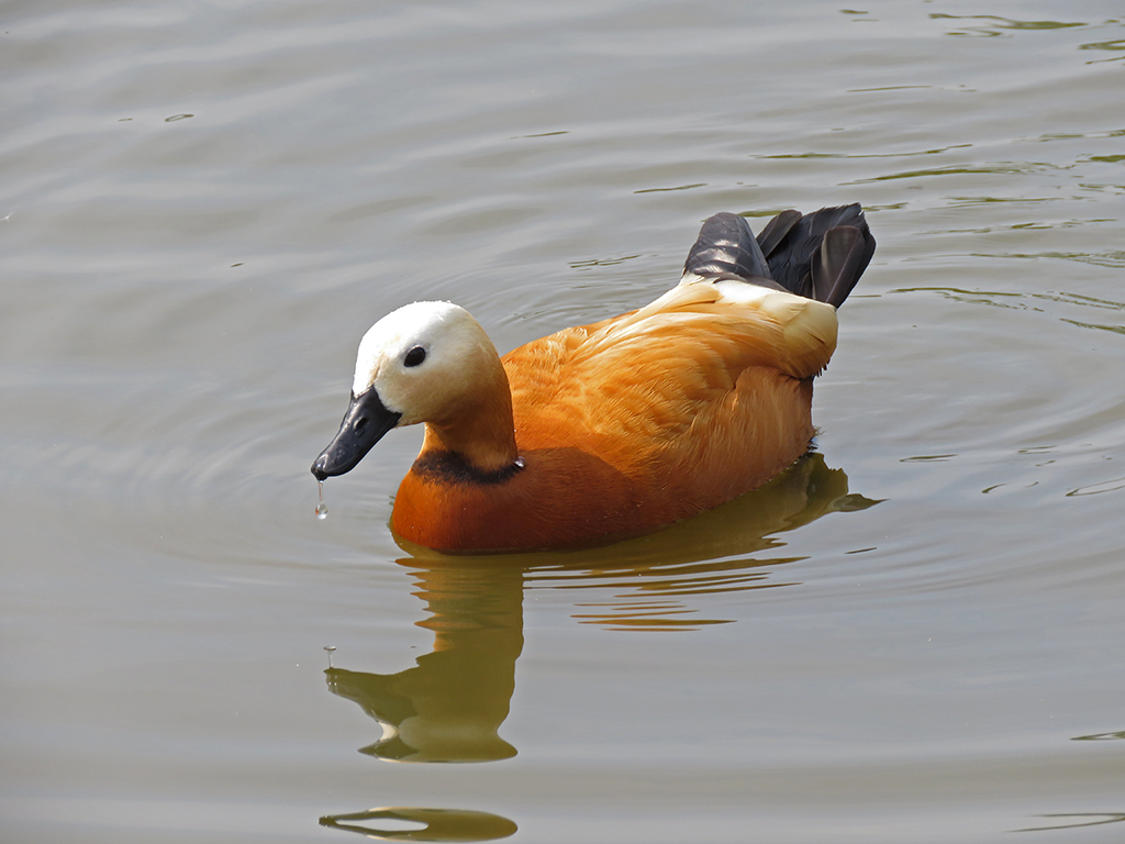
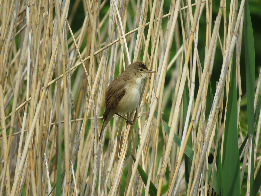
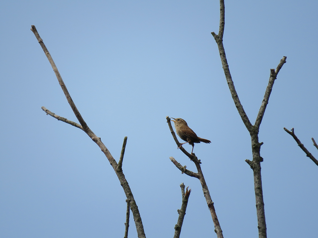
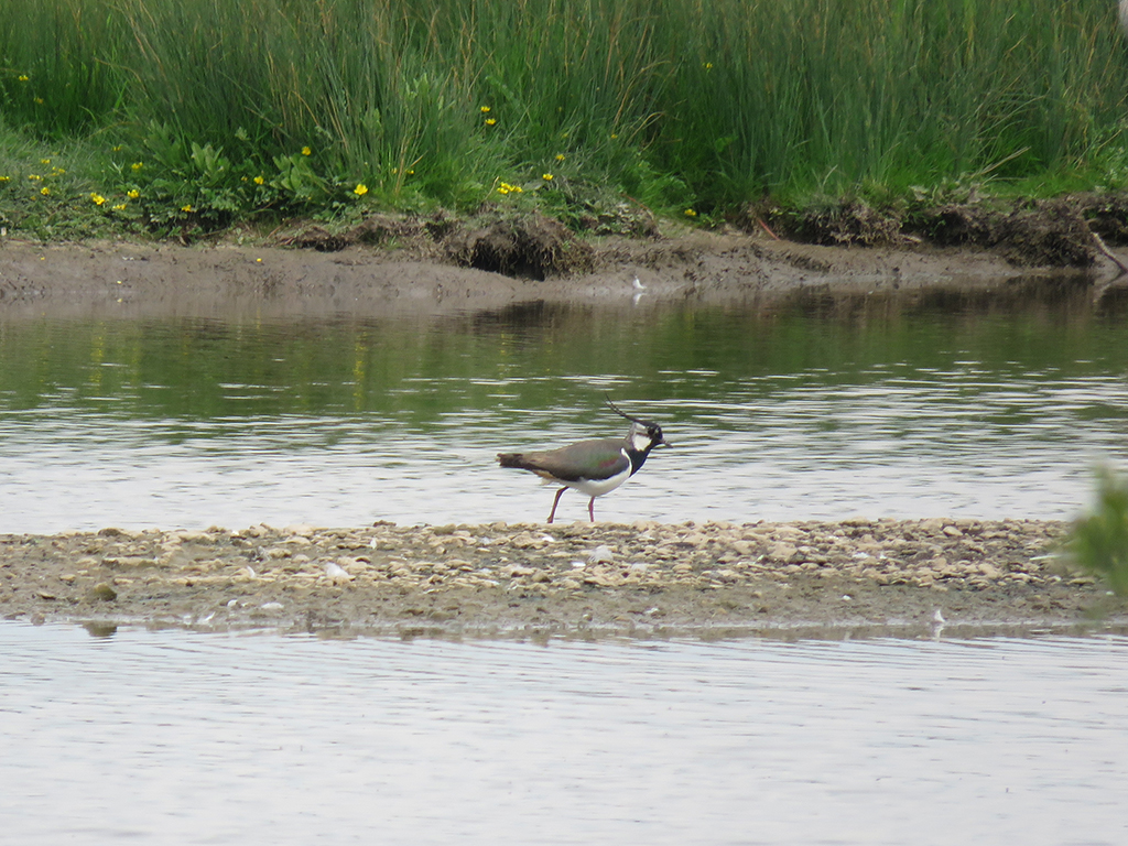
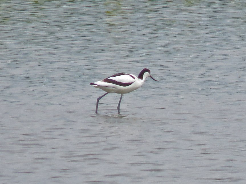
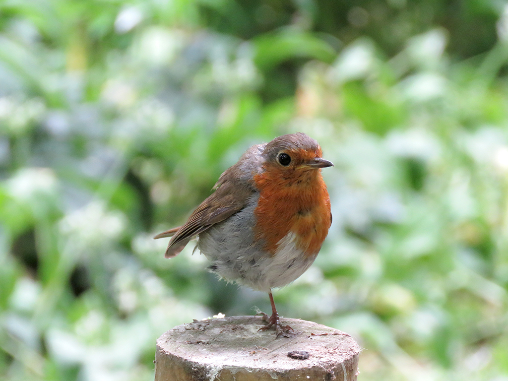
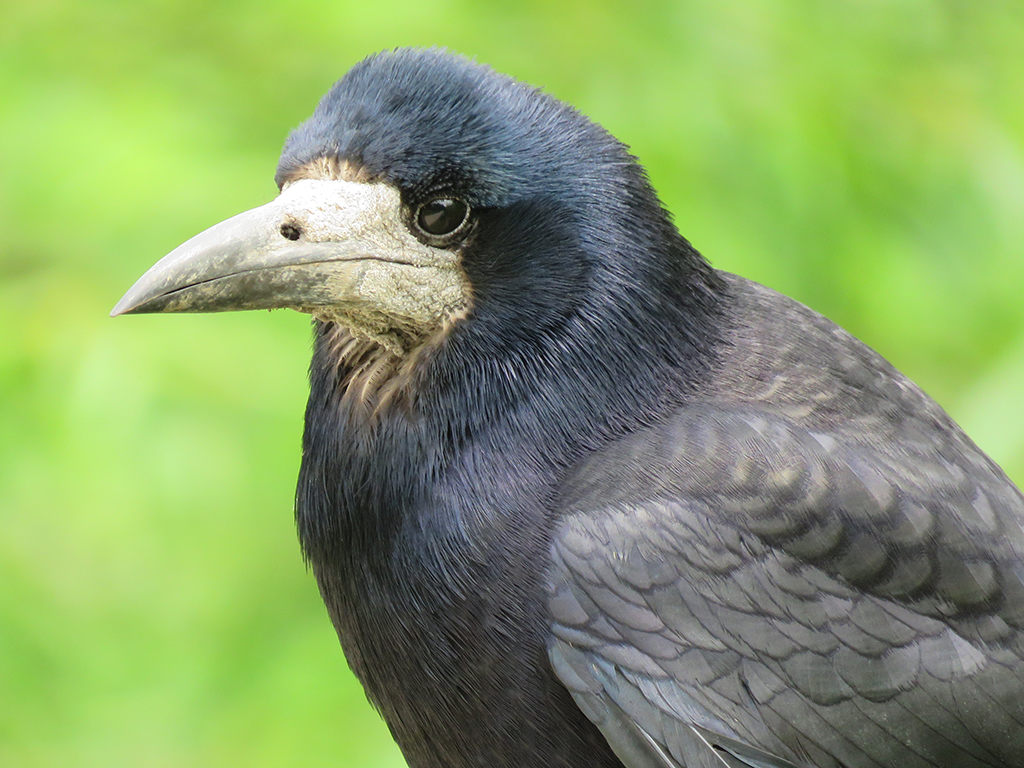
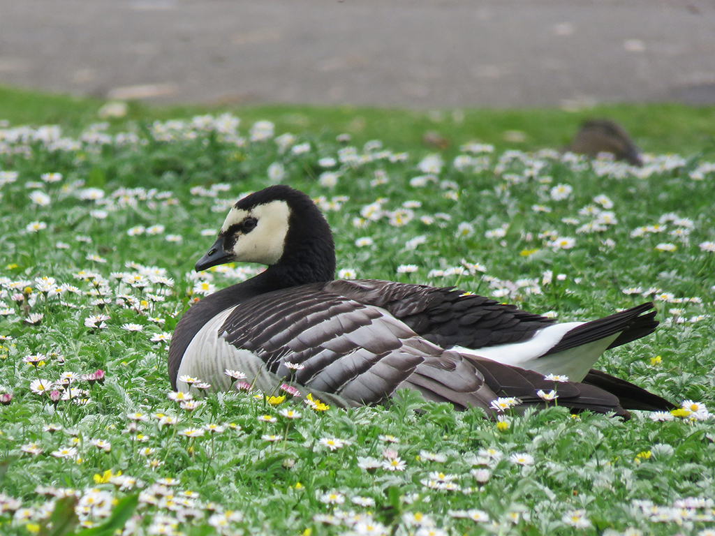
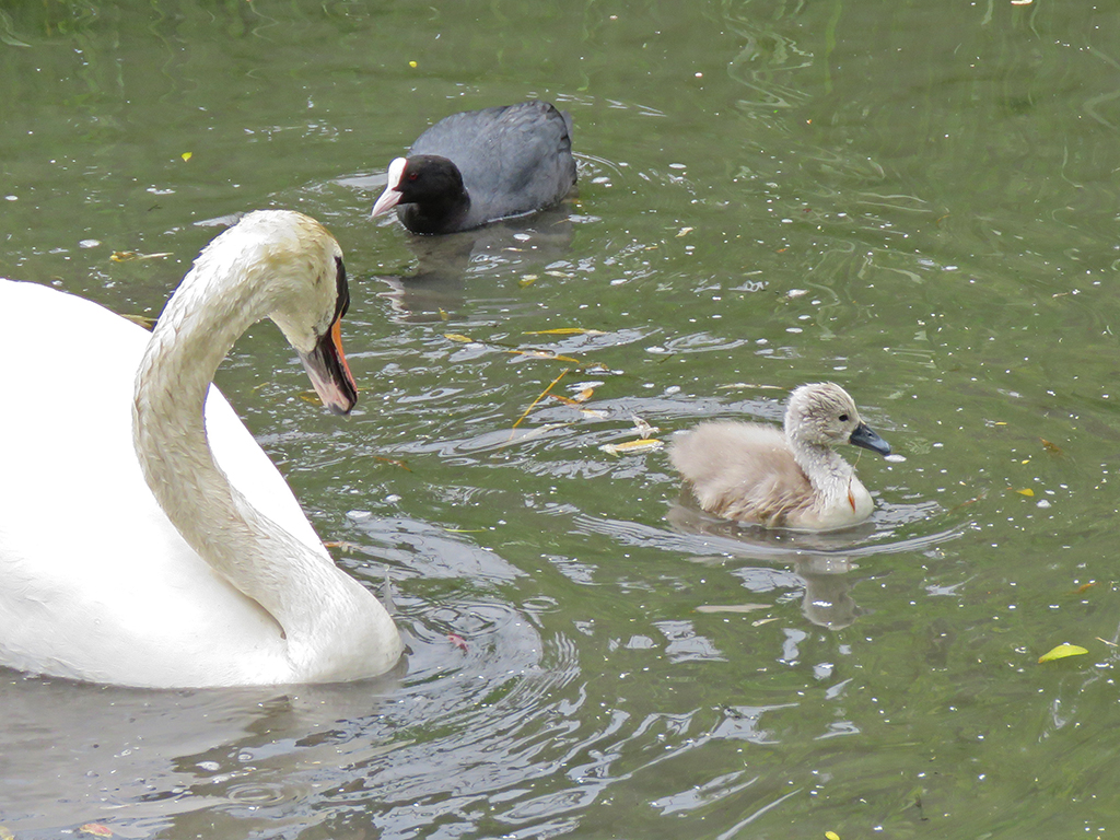
Tufted Ducks were not rare during our entire visit, but photo opportunities of this species were. This one was at the visitors’ centre, but should be representative of the many I did see out in the wild.Black-headed Gulls are possibly the only – um – black headed gulls without black heads. It is actually a dark chocolate brown. I’ve seen this species as a vagrant in the USA, but this is a native, free-flying bird.The Smews at the visitors’ centre seemed captive, but a few of the birds flew to adjacent pools, so I listed these, but perhaps I shouldn’t have. I’ve not heard anything from the eBird reviewer on the matter. This one is a drake.Female Smews are much different looking than the drakes (males).Common Goldeneyes are also seen in the USA, this pair were at the visitors’ centre, but I saw some flying out in the marshes later in the morning.A Smew couple on land.Rooks are common enough around the UK, and the ones throughout the park were quite photogenic and accommodating.Like some of the other duck species, Ruddy Shelducks were at the visitors’ centre pools (like this) and out in the wetlands, too.Waterfowl dominated the visitors’ centre, but once out in the park and on the trails, there were more songbirds, like this Reed Warbler.The tiny Eurasian Wrens made up for their size with loud, ringing voices. The song is reminiscent of Song Sparrows in North America. This caused me a deal of confusion throughout the trip.Photos out over the marsh and meadows from some of the blinds were tough. This shot of a Northern Lapwing and many of the upcoming shots are heavily cropped.One of about a dozen or so Pied Avocets feeding in the shallow water.While not listed as particularly rare, this Eurasian Spoonbill seemed to be causing quite a stir among the other birders at the blind.In the wooded area near one blind, I saw this one-legged European Robin. It seemed to be managing fine, but I wonder what happened.At the next blind, it took some patience to wait for one of the Common Kingfishers to arrive back at its mud bank cavity nest site.Another handsome Rook. This one was near some picnic tables, looking for an easy snack from the park patrons.A close-up of a Rook. It’s thought that the partially naked face is due to Rooks being opportunistic omnivores, not ones to pass up carrion. Like vultures, this avoids facial feathers being fouled by blood and such.Back at the visitors’ centre, this Barnacle Goose flew in and landed on the lawn to rest.Many of the birds at the park (including the visitors’ centre) are breeding and had chicks, like this Mute Swan and its cygnet. This is one reason it is difficult to completely exclude the exhibit birds from lists. They are obviously breeding and some are flying about.
I’ve left off photos of some of the more exotic birds – like the Nene, a South American bird called a screamer (for good reason!), and some others that are clearly not UK or European birds. I may post them as bonus or extras in the future.
Here’s the somewhat confusing eBird list for the day. Ruth and Mrs. Lonely Birder came to pick me up after shopping in nearby Gloucester.
[Note: I realize it’s taking me some time to get through these posts. Please bear with me. It’s been a hectic summer]
May 18, 2019
Continuing our travels along the south coast of England, we drove back through Cornwall and to the ancient village of Marazion [map]. Off shore on the island of Saint Michael’s Mount is a castle and church that can be visited by foot during low tide. When the tide comes in, the causeway is submerged and the mount is only accessible by boat or amphibious vehicle.
A view of Saint Michael’s Mount, looking at the harbor side.
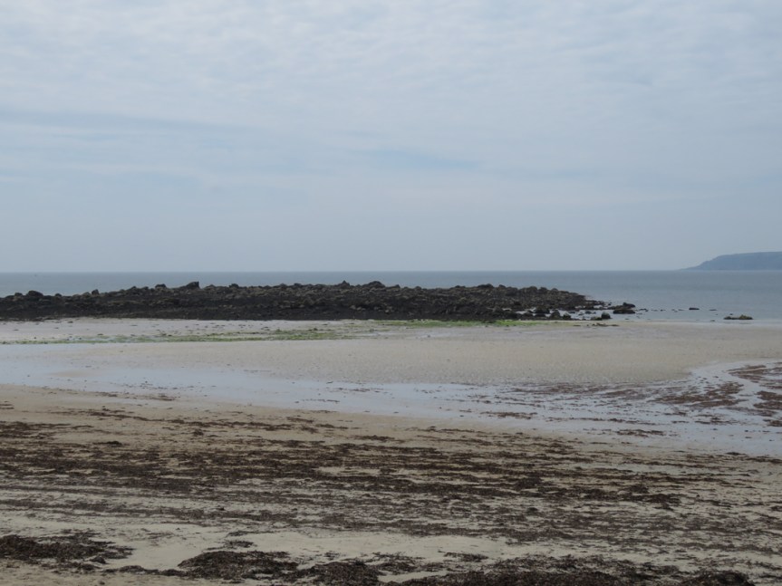
The beach itself is quite flat, and when the tide is out one can wade quite far in places. A beach like this would be stacked with people, blankets, chairs, and fishing poles back home in Florida. Here, the beach was mainly empty, with people enjoying sea views from benches, restaurants, and shops from the village.
You can see how wide the beach is, and the waters beyond were quite shallow.
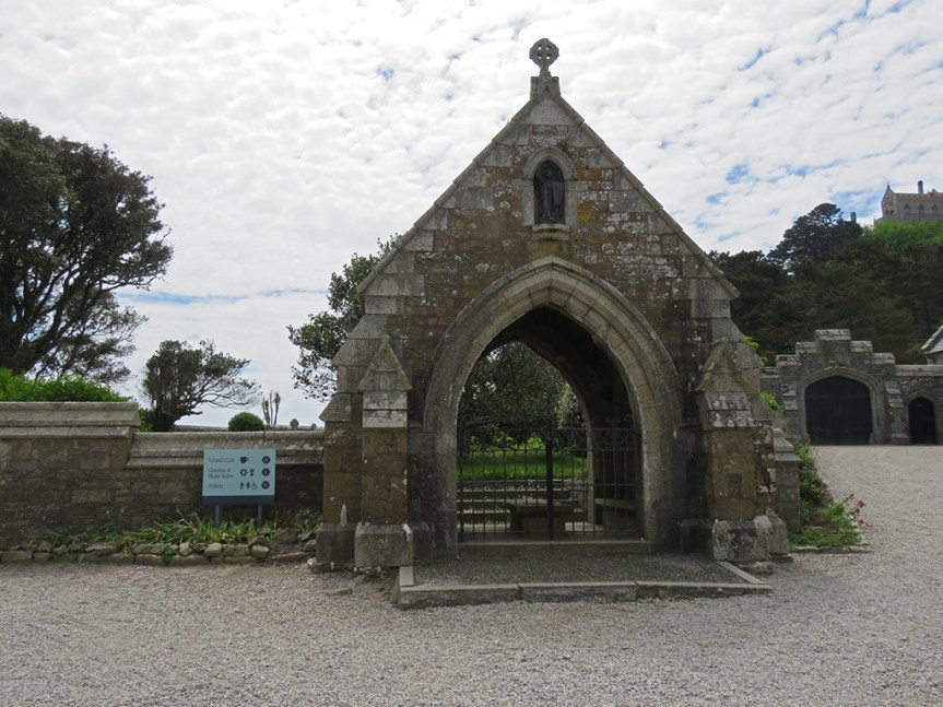
The castle and chapel are impressive, even at a distance and I imagine the views commanded from this vantage-point are impressive. People do live and work on the island, and an order of monks is active at the chapel.
Part of the castle and the chapel atop Saint Michael’s Mount.
The main part of the island was gated and closed, which seems a shame as there are extensive gardens and a museum I would have liked to see. I hear the geology is unique and impressive as well. But it was a lovely diversion nonetheless, but we couldn’t stay long as the tide was about to come in, which threatened to strand us on the island (or at least have to hire a boat) as the causeway would be inundated.
Access denied. Sorry to have to go, Saint Michael’s Mount…
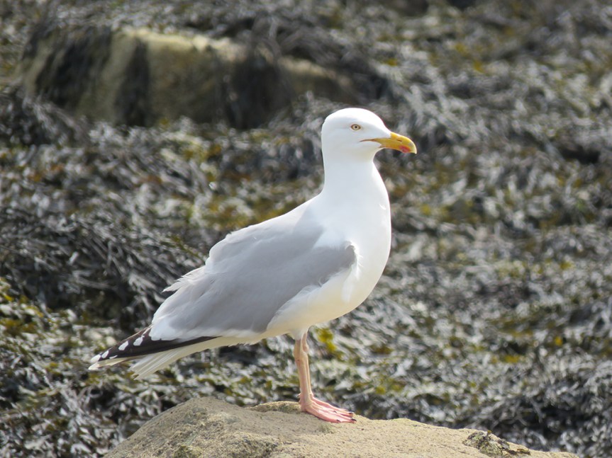
Meanwhile, back on the beach…
Forewarned is forearmed?Aw, this Herring Gull looks harmless!
We walked back to the beach and then into Marazion, and had lunch at a cafe that had some local fare, known as a pasty. Pasties are a pastry filled with meat and root vegetables. Traditionally, they were miners’ food. The thick crust around the edge serving as a handhold that wasn’t normally eaten since the miners’ hands might be contaminated by arsenic or other poisonous substances related to mining.
Lovely pasty! (Thanks, Ruth, for the photo!)
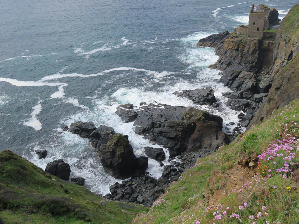
From Marazion we worked our way west along the coast until we reached the ruins of the Botallack Mine, not far from the town of St. Just [map].
Windmills are perhaps the most visible sign of how the UK has moved away from coal generated power. While we were there, the country had just had of a couple of weeks were no coal at all was used!
This stretch of coast has to be one of the most dramatic and impressive sights we saw in our whole trip. The juxtaposition of the natural beauty of the rocky coast and dramatic cliffs with the many abandoned mining structures makes for a nearly unparalleled visual experience. Add in the roar of the waves on the rocks below and the wildflowers blooming, and you can imagine what an experience this was.
The remains of the mining engine houses from the Botallack Mine.
As we approached the cliffs, a low fog was dispersing along the coast, which made the scene even more fantastical.
In ways, this landscape seemed a convergence of the sea cliffs we saw in Wales, the flowers and grass of Dartmoor, and the ruins of Minions. Very England.
Seabirds were circling below (Northern Fulmars, as it happens) as waves and foam churned on the rocks. We were only able to walk so far down along the cliffs due to trail closures for safety.
From these structures, miners actually tunneled under the seabed up to 1/2 a mile (800 meters) to get the valuable copper ore, even breaching the ocean, flooding the mines.It would be hard to find any safe harbor approaching this part of the north coast of Cornwall.
The scope and scale of the cliffs are hard to grasp from photos alone. They are hundreds of feet high, some with very narrow places to walk out on. The lingering fog helped confuse the distance cues a bit, but added to the drama.
Most of what we saw in the UK was spectacular and I’d trade none of it, but Cornwall definitely stole a bit of my heart.
We were very near both Penzance and Land’s End, but we stopped at neither. On a future visit I would like to spend more time in this part of England and take it all in, natural and human.
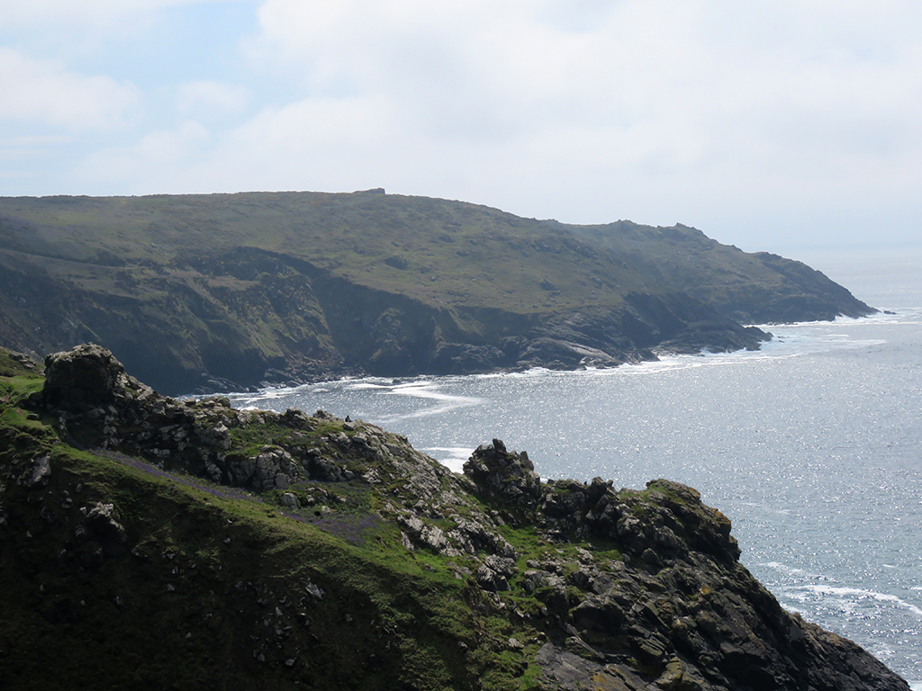
Darren says this is looking toward Sennan Cove, and Land’s End (beyond).
We spent some time marveling at the scenery before climbing back out, past the mining houses and the furnace ruins, looking up at smokestacks that seem to defy gravity and the elements.
Here’s more sense of scale: The two small vertical objects on the left are people standing on the cliff edge.
As we made our way back toward Bristol, we crossed into Plymouth by way of the Torpoint Ferry, rather than the bridge. It was fun.
Two boats run, one in each direction, and both were full. Photo thanks to Mrs. Lonely Birder.
Mrs. Lonely Birder and I got out of the car and went up on the deck and enjoyed some fresh air and a look at a few Royal Navy Ships. The ferries run on cables between both sides which is a safer, if more boring option for ferries ;-).
Some Navy ships in the harbour. Photo thanks to Mrs. Lonely Birder.
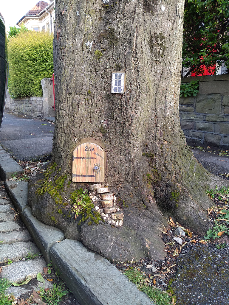
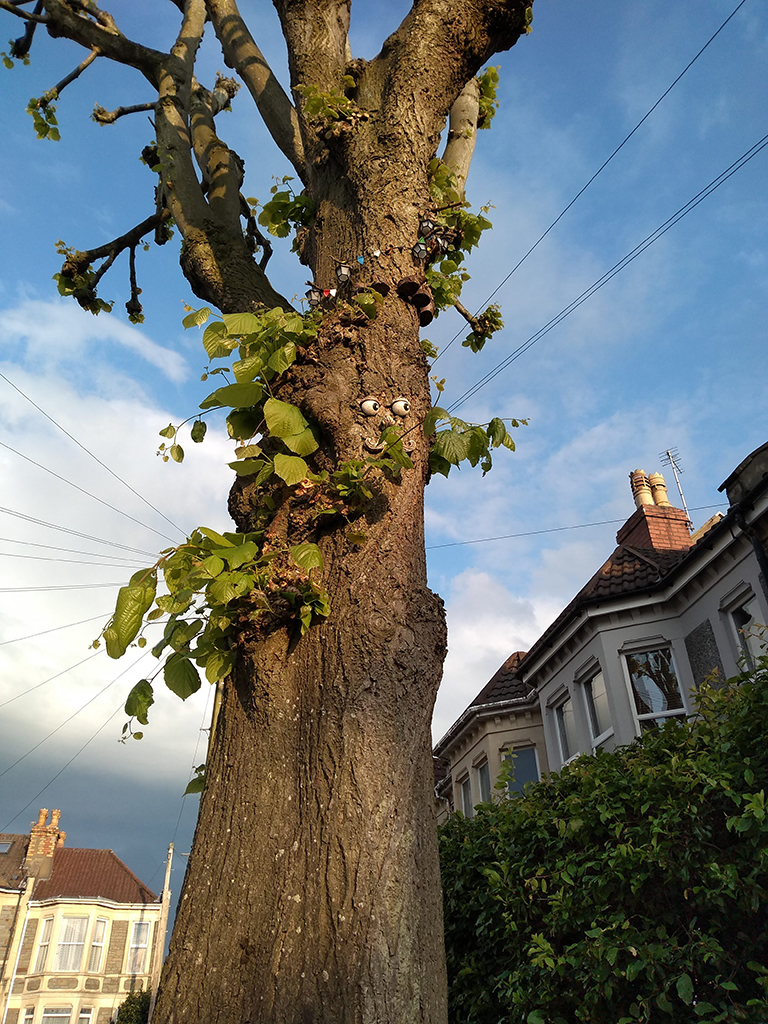
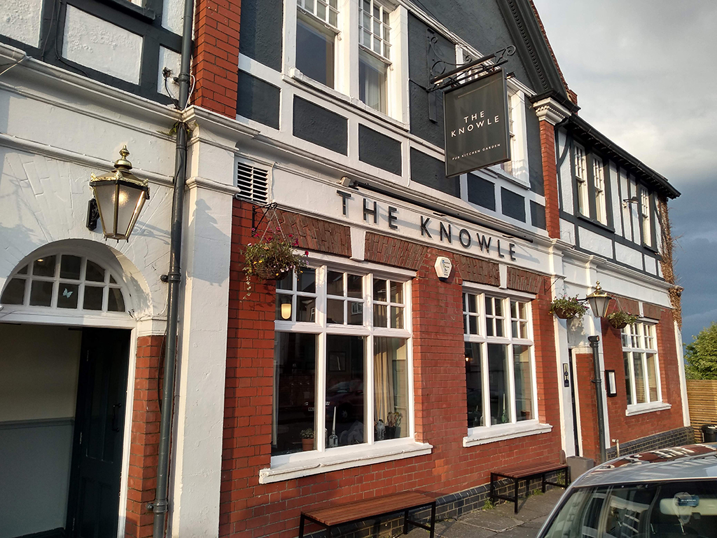
We eventually got back to Bristol and walked to the local pub (The Knowle) so those that imbibe could have a pint and we unwound a bit. On the way there, we passed some trees that have been decorated like fairy homes!
We didn’t knock to see if anyone was home. Photo thanks to Mrs. Lonely Birder.This tree ended up looking a bit Entish, if you ask me. Photo thanks to Mrs. Lonely Birder.
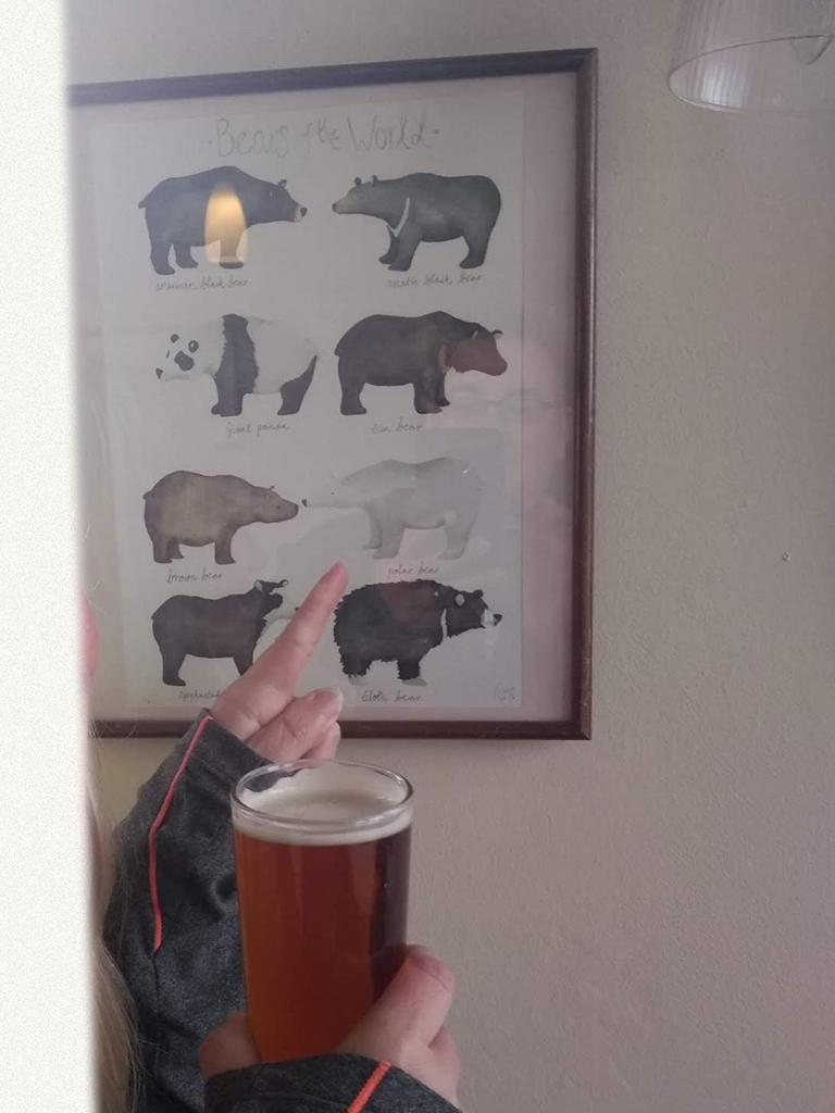
We ended the day out at the pub, in which Mrs. Lonely Birder saw a familiar friend, reminding us of our previous epic trip to Churchill, Manitoba! I’ll leave you with a couple of parting shots.
The local pub. We didn’t stay long, but it was sort of a checklist item of ours. Cheers, mate!It was pure cool to have a Polar Bear drawing by our table, linking our life-time trips together!
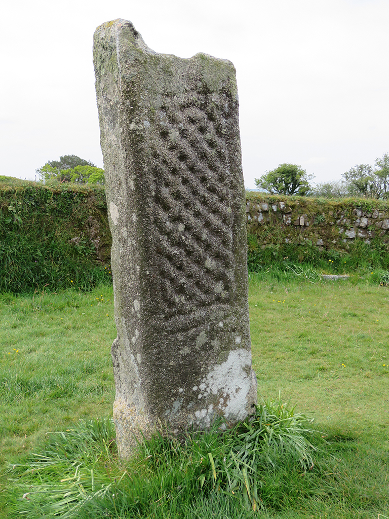
After a night in Plymouth, our adventures took us further afield into Cornwall and Bodmin Moor [map]. Driving past the ever present windmills and fields of the English countryside, we first stopped at a pair of stone monuments. These would have been the bases for wooden crosses, one of which bears an inscription commemorating King Dungarth (Doniert in Latin), the last King of Cornwall who is purported to have drowned nearby in 875 AD.
King Doniert’s stone is one of two “cross shaft fragments” that were raised upright during excavations in the 19th Century.
According to English Heritage, the Latin inscription on the shorter stone (Doniert’s) is translated as “Doniert has asked [for this to be made] for his soul[’s sake’]”.
The taller fragment has no commemoration, but its proximity to King Doniert’s stone and the discovery of an underground cross-shaped tunnel beneath the stones indicate this was an important early Christian site in the 9th Century.
This stone fragment is quite a bit taller, but bears no specific inscription. Both stones are easily accessible on the roadside and the stone enclosure shows evidence of cows and sheep using the area to graze.These sides of the stones seem more weathered and eroded.
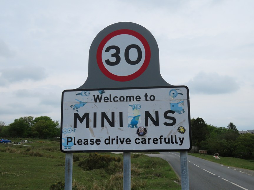
From these ancient memorials, we made our way along the southeast edge of Bodwin Moor to the village of Minions. In this post-Despicable Me world, it was all too easy to snort-laugh and bring images of Gru’s mostly loyal underlings to mind. It seems to be a common enough thought.
I don’t know if the stickers were sanctioned or not, but I suppose it was inevitable.
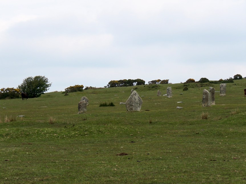
The biggest attractions here are The Hurlers stone circles and a natural landmark called the Cheesewring. The Hurlers are a set of 3 remnant stone circles and a pair of stone markers (“The Pipers”) from the Bronze Age. Many of the stones have been eroded away or “borrowed” as building material through the centuries.
The exact age of these stones is uncertain, but they are clearly ancient and well weathered. Some have suffered the effects of close-grazing cattle, which helps weaken the stones’ bases, causing them to tumble over.
The three circles are nearly in alignment and thus likely intentionally related. The local legend has it that the stones are in fact transformed men who dared to play the ancient game of Hurling on a Sunday and were cursed. It must have been some game!
More stones with cattle grazing and the Cheesewring in the distance.
Close up, the stones are placid, yet evocative of ancient and mysterious cultures and beliefs. Through the ages people have ascribed all manner of mystical energies associated with stone circles, and it’s easy to see why. It’s awe inspiring to see this ancient handicraft, abandoned yet so accessible.
One of the taller and more intact stones.Looking out from the center of one circle to a trio of stones.
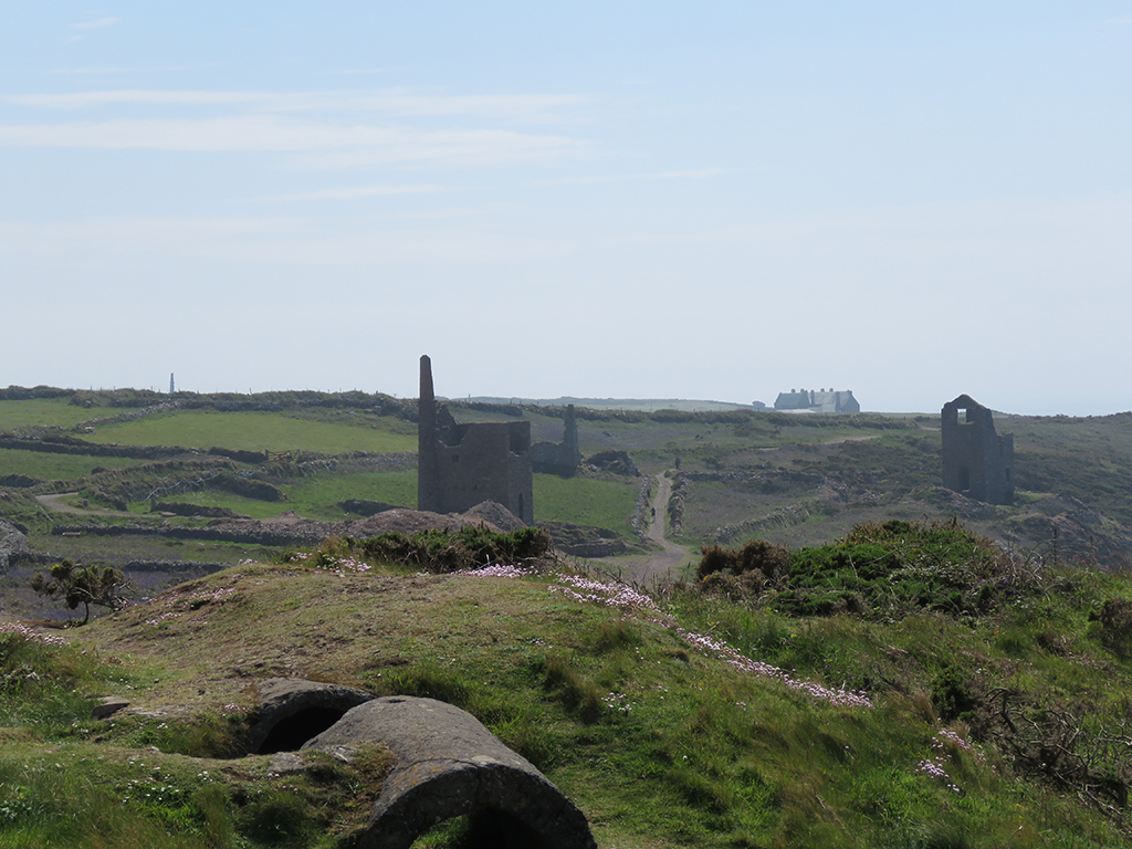
Nearby the stones were several building ruins. These used to house large steam engines, which helped drive pumps to keep water out of the mines as well as circulate air.
One of the mining engine houses. This is a not-uncommon sight in much of Cornwall.
Much of the area beneath the Hurlers consists of mining tunnels, and some of the rumpled appearance of the landscape is due to subsidence. It’s unlikely one would simply drop through the ground casually walking, but it was perhaps best practice to avoid any obvious “dips” or potholes.
This ruin serves as a small local museum, but it was closed while we were there. These sites are well preserved as a part of England’s heritage.
It’s nearly impossible to separate mining from Cornwall, or indeed much of southwest England and Wales. Just about every site we visited had evidence of mining from the 18th through the 21st Century.
After taking our fill of the Hurlers, we made the hike up Stowe’s Hill toward the Cheesewring, one of several granite outcrops sculpted by the wind over countless years. These are not artificial structures.
The Cheesewring (on the right) is the more prominent of several natural artifacts that make up the tor on Stowe’s Hill.
The Cheesewring gets its name from it’s somewhat similar appearance to cheese slabs that were pressed in its namesake device generations ago.
Here you can see Darren standing by the Cheesewring, for a sense of scale. The small stack of stones just in front of him was placed there as a potential aid should the larger stones fall over – it is not actually touching the Cheesewring.
The top of the tor overlooks the countryside and some well used granite quarries. Darren says that a lot of the granite here was used in London, particularly for Tower Bridge. The top of Stowe’s Hill provided us with some good vistas, despite the ever threatening rain showers and obscuring mist.
The view from Stowe’s Hill overlooking Bodmin Moor.
As with most of the rural sites we visited, cattle and sheep have free rein and are grazing just about everywhere. There was evidence of grazing all the way to the top of Stowe’s Hill and right around the Cheesewring and the other outcrops.
A lamb resting, unconcerned with our proximity. Most of the ewes we saw had lambs with them.
We made our way back to Minions and (after meeting back up with Ruth, who had some other business to attend to) drove back to Devon and onto Dartmoor. We stopped at the Two Bridges Hotel (in the village of Two Bridges, where else).
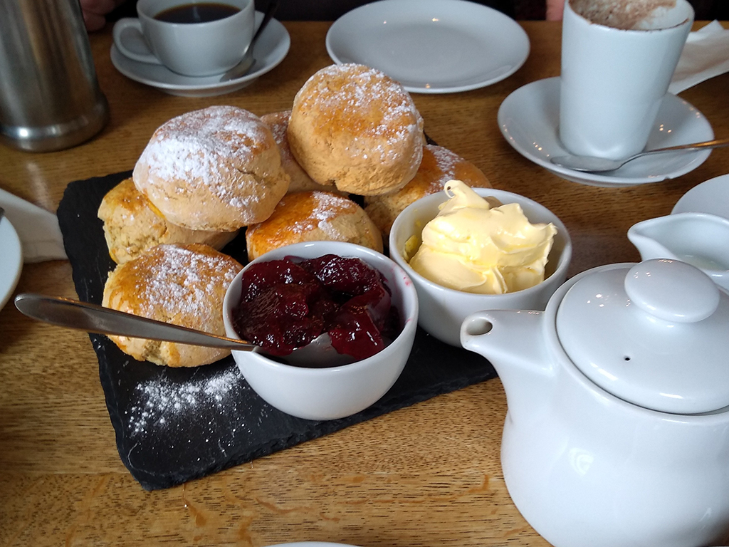
Tea, as you may not know, is actually a light meal in Britain, not just a hot beverage. A Cream Tea is tea served with scones, clotted cream, and jam. We had heard a lot about this from Ruth and Darren, but unwittingly stumbled into a long running feud between Devon and Cornwall.
I’m hungry again just looking at it. My wife took this and the next photo.
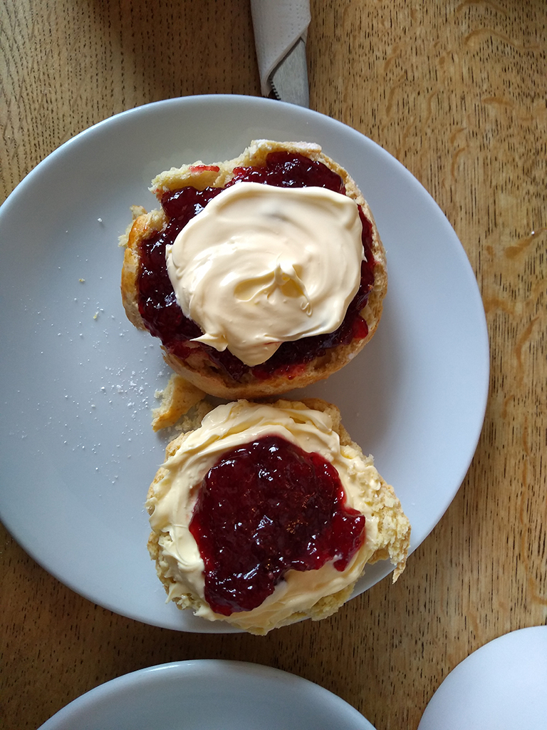
According to those from Devon, the “proper” way to have Cream Tea is to split the scone in two, spread the cream first and then put the jam on top. The Cornish way is to put the jam on first and then spoon the cream on top. Ruth is a proponent of the Devonshire method while Darren prefers the Cornish method.
Whether the Devonshire way (bottom) or the Cornish way (top), our Cream Tea was fabulous.
There was much good-natured jibing, and I have to say I preferred the Cornish way (you get more of the cream taste that way), but no matter how you take it, this was a real highlight of the trip for me. Plus, my hot chocolate (in lieu of the tea and its caffeine) was amazing as well.
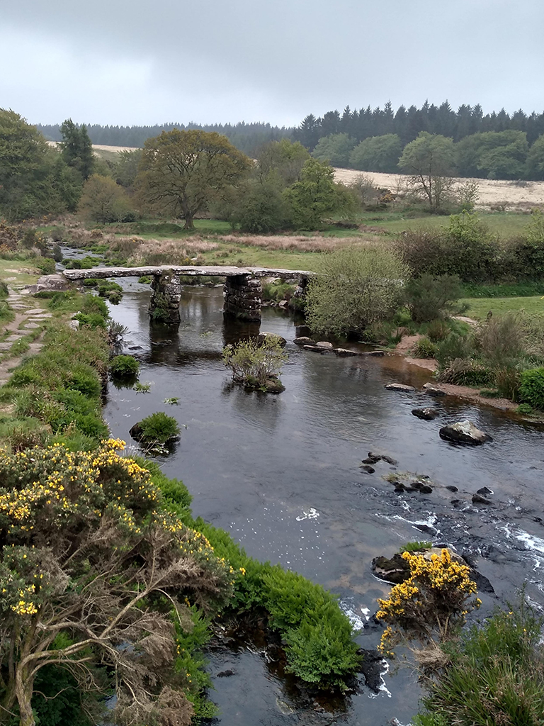
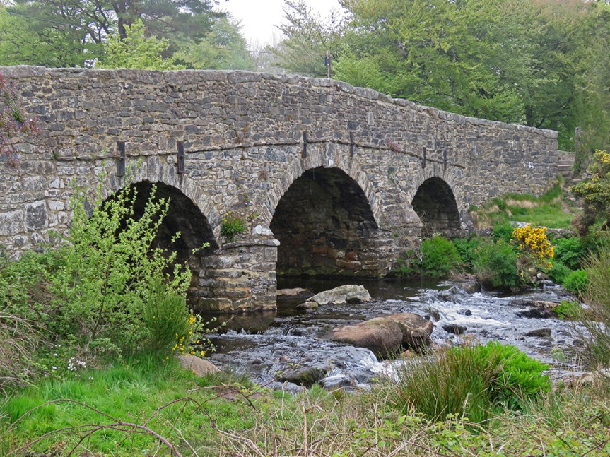
With full bellies we made our way back out and drove further into Dartmoor, making a stop at picturesque Postbridge and its medieval clapper bridge. Clapper bridges are simple slabs of rock placed across a river to cross it. In this case, two piers of stone were placed as supports.
The East Dart River flowing beneath the clapper bridge. Photo taken by my wife.
The adjacent roadway bridge was beautiful as well.
The roadway bridge over the East Dart River.
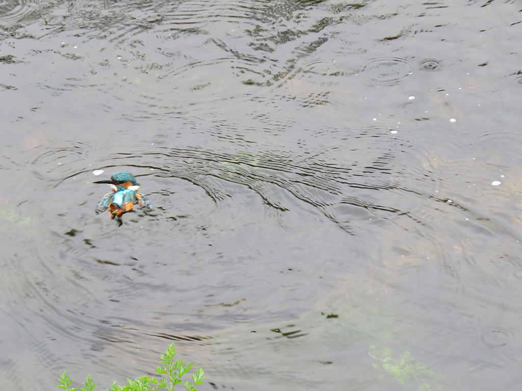
While we were admiring the view (and I was passively birdwatching), I noticed some commotion. A woman had been trying to rescue a Common Kingfisher and it had tried to get out of the cardboard box it was in and had fallen into the cold water below.
This Common Kingfisher was in distress. I though maybe it was a fledgling given the relative shortness of its bill, but I don’t know the species well enough.
A traveler who was hiking his way along the river immediately waded in and scooped up the bird, which was now shivering with cold, and the woman asked if we knew anyone who could help. I suggested any local wildlife rehabilitators, and she said she had tried and had no luck. Her intention was to dry and warm up the bird and give it time to recover and then release it. We wished her luck and thanked the man, who went on his way, wet and cold himself.
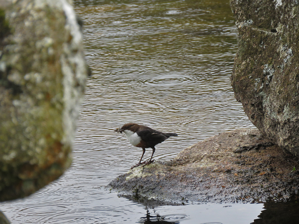
There were other interesting birds by the river as well, including a White-throated Dipper, gathering invertebrates of some kind, likely to feed its young. Dippers are fun little birds. They are adept at running along the bottom of fast moving streams, often completely submerged in pursuit of prey. They can also dive and swim quite well.
A dipper foraging beneath the clapper bridge. You can just see the long grappling claws it uses to keep anchored to rocks, especially under water.
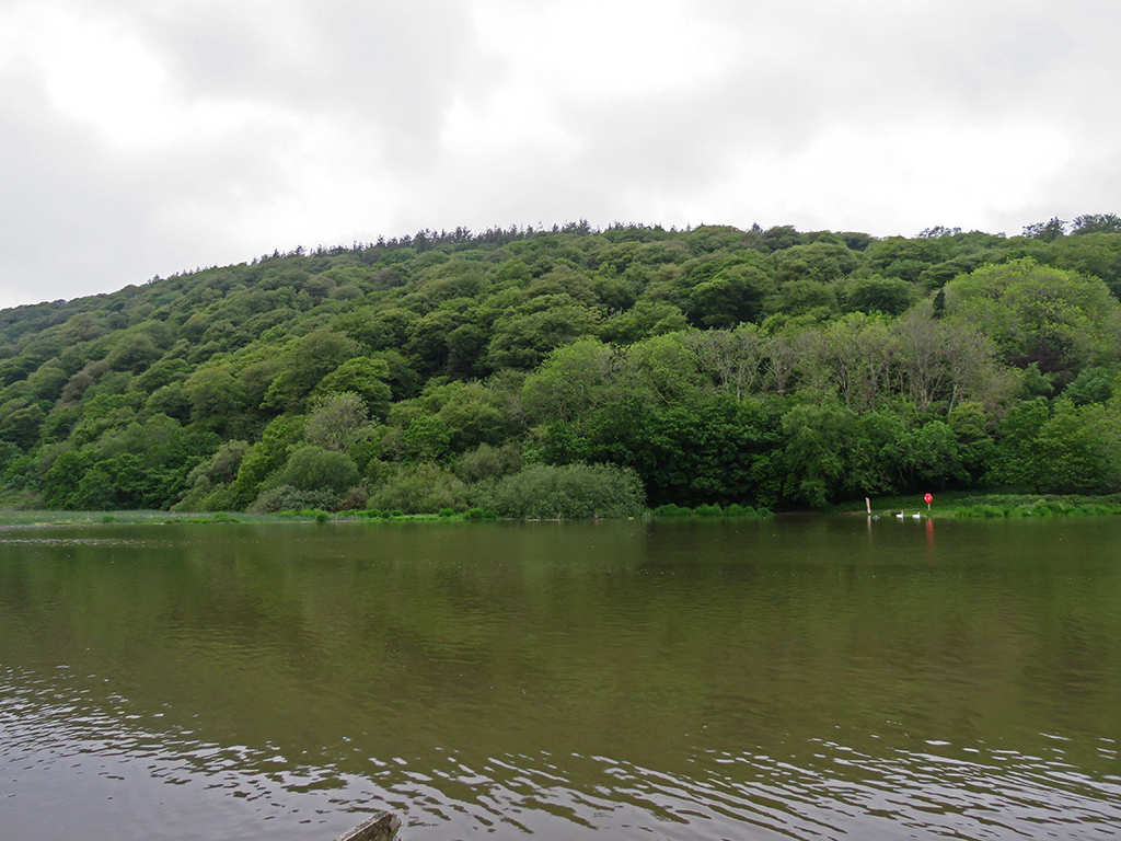
Another short drive brought us to Burrator Reservoir on the River Tavy and a nearby nature trail. Burrator provides some of the drinking water for Plymouth and surrounding places.
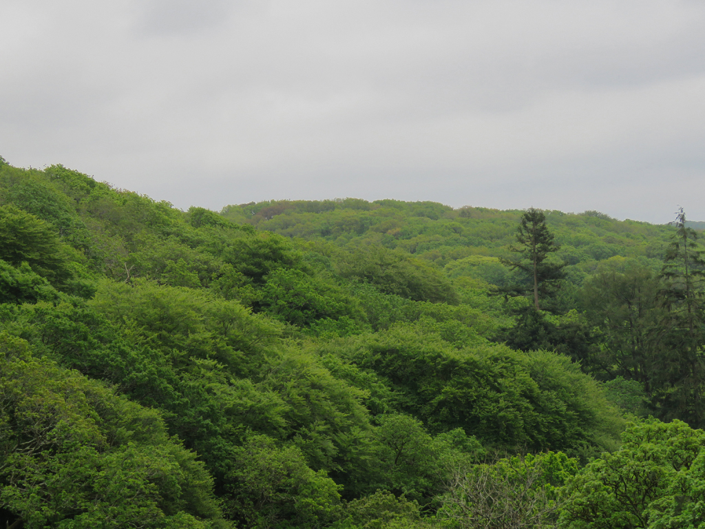
The area right around the dam is wooded with a tight canopy.
It was quiet around the reservoir with not much traffic and the weather was calm, and the sun had peeked out every now and then.
We made our way along a trail after passing a small but beautiful waterfall and cascading stream. The sound backdrop was serene and almost idyllic.
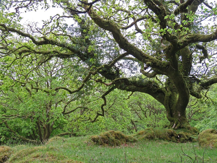
The vegetation here seemed well suited to damp weather, with many of the older trees covered in moss.
And old and gnarled tree, covered in moss.
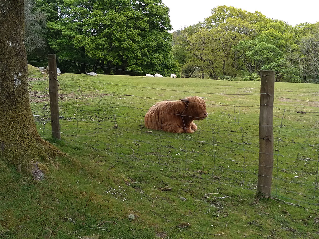
As we walked the ground gently rose as we make our way up onto the moor. Even here, there were cows grazing and resting in fenced off fields. In Britain, the concept of conservation is a bit different than here in the States. Here, the usual focus of environmental conservation revolves around preservation or the return of the landscape to some idealized natural state. In Britain, the majority of conservation efforts involve preservation of rural landscapes, such as farms, villages, and grazing lands.
This shaggy-haired bovine had a very 60s mop-top vibe about it.
All the while we were walking up the path, birds were singing and darting in and out of the trees. This included Willow Tits (differentiated by their song), Coal Tits, and quite a few songs I could not identify.
The ever ubiquitous robins were singing in full force. These birds must be among the most adaptable in the world.
We didn’t walk much farther and turned back down the trail to the car park (that’s a parking lot, fellow Americans) and headed to our last stop of the day, at Lopwell Ford, on the River Tavy.
The River Tavy was still on the rise from recent days of rain. You can see the far side of the ford to the left of the red marker on the far shore.
The water level was fairly high, and we could see it rise on the level indicator signs in the river. When the water is lower, vehicles can cross (ford) the river and get to the other side. Suffice it to say, without a taller vehicle like a truck or SUV with a snorkel, we weren’t managing that! But is was a pretty stop.
Mrs. Lonely Birder enjoying the early evening by Lopwell Ford and its nearby buildings.
With that, it was back to Bristol to plan our next days’ excursions. Dartmoor is an amazing place, and I can imagine spending two weeks just exploring that area alone. But for us, it was on to the next!