
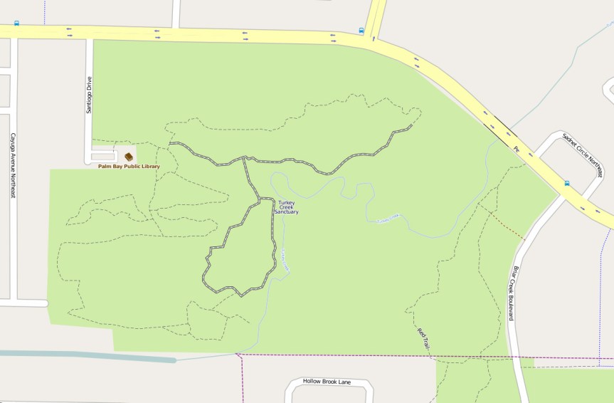
I notice that there is no truly decent map online for Turkey Creek Sanctuary. I did find a reasonable depiction of the trails and boardwalk on OpenStreetMap, though some of the ancillary structures (gazebo, radio tower, pump station, etc.) are not displayed. In this map, trails are dotted lines (The Sand Ridge Pine Trail is the northernmost) and the boardwalk is shown in the thick white lines with the black dashes along the center-lines. (The creek overlooks are also not shown.) [UPDATE: I added some map updates to the trails, including a few of the overlooks, the canoe deck and the radio tower. It may take some time for all the updates to show up on the map.]
Click through the map above and it will take you to the full OSM map where you’re free to zoom, pan and play around to your heart’s content.
